
Maritime Map
Carte de navigation : le bon choix avant d'embarquer
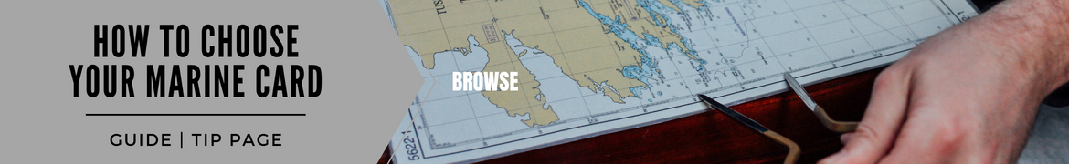
La carte marine regroupe les éléments et informations nécessaires à la navigation maritime, elle permet de se situer et de se diriger en mer. Une carte maritimetient compte des conditions climatiques, notamment des marées, des courants, de l'état de la mer et des dangers sur la route.
La carte de navigation, voilà l’un des éléments essentiels à emporter lors d’une sortie en bateau. La réglementation n’est pas la même selon votre type de navigation. En revanche, selon le SHOM (Service Hydrographique et Océanographique de la Marine), l’obligation d’emport d’une documentation nautique s’applique à tous les navires, tout comme l'immatriculation. Alors que vous soyez adepte d’une navigation côtière, hauturière ou fluviale, la carte de navigation est obligatoire dans le cadre d’une activité professionnelle. Pour les bateaux de plaisance, ce n’est pas le cas, mais la carte de maritime bateau peut vous apporter une aide non négligeable et vous offrir la sécurité nécessaire lorsque vous montez sur votre navire.
Et chez Nautisports, nous avons ce qu’il vous faut! Chez navicarte, qui appartient à la marque Plastimo, avec la carte , vous aurez le produit idéal pour une navigation légère le long des côtes françaises et vous coûtera seulement 8 euros. En papier et au format A3, cette carte de navigation résiste à l’eau et au pliage grâce à un procédé de navicarte qui est de charger le papier avec du latex. Retrouvez également ces cartes marines, toujours chez navicarte, dédiées à l’Italie, l’Espagne ou la côte Atlantique française.
Autres cartes maritimes disponibles sur notre site, les de chez Plastimo. Etablies selon le SHOM, ces cartes de couleurs différentes vous permettent de déterminer les dangers que pouvez retrouver lors de vos sorties sur les eaux, que ce soit avec un bateau à moteur ou un bateau de plaisance. Disponible à la vente au prix de 29 euros, ces cartes sont rééditées périodiquement, pour rester à la page en cas de changement sur un ou plusieurs secteurs.
Toujours chez Plastimo, optez pour la . Ces cartes maritimes bateau vous indiquent toutes les informations concernant la circulation si vous décidez d’une navigation le long de la côte d’Azur. Le format de cette carte marine méditerranée est au format A2. L’achat de cette carte vous donne accès à un lot de 20 à 30 cartes à différentes échelles. Autres informations disponibles, le détail des marinas et des zones de mouillage. Retrouvez ce modèle de carte marine méditerranée, sur notre site en ligne, au prix de 46 euros.
Code et sécurité
Parmi les documents, ou plans, à posséder sur votre bateau et toujours pour votre sécurité, il ne faut pas oublier non plus le . Rien d’original sur ce produit, juste le regroupement sur une même fiche du règlement international pour prévenir les abordages en mer. Ce modèle de carte maritime, ce code de mer, vous permet de prendre acte sur le nouveau règlement international que ce soit pour les bateaux de plaisances en eaux intérieures, ou pour les navires sur les eaux internationales. Et garder en ligne de mire les informations nécessaires à votre sécurité. La signalisation maritime disponible sur cette carte correspond aux ouvrages SHOM 2B et 3C. Disponible au prix de 9,50 euros seulement.
Autre produit disponible pour assurer votre sécurité, le. Ce guide de navigation cartographie chaque rivière, canal ou voie navigable en France (mais aussi quelques pays limitrophes tels que la Belgique, la Suisse ou l’Allemagne). L’achat de ce guide, disponible au prix de 19,80 euros, vous donnera plusieurs informations sur les itinéraires à suivre, l’environnement, les lieux de mouillage… Bref tous les renseignements pouvant être utiles à la navigation. Les cartes maritimes bateau que vous pouvez retrouver à l’intérieur sont agrémentées de photos techniques et touristiques.
Cartes marines: pour une sortie en eau en toute sécurité
Que vous soyez propriétaire d’un bateau à moteur, peu importe sa puissance, un bateau plaisance, une mise en garde est nécessaire et une connaissance de votre environnement également. L’électronique, notamment avec les smartphones, peut vous être utile, mais rien ne remplace les cartes en papier qui peuvent vous sauver la mise en cas de problèmes. Les cartes marines, les fiches techniques, le code marin, vous permettent d’assurer votre sécurité, et celles des autres, tout en ayant une longueur d’avance sur les évènements. Retrouvez en ligne sur Nautisports.com, une large sélection de documents essentiels dédiés aux navigations maritimes, et tous réglementés par le SHOM, à emporter à bord de votre bateau ou navire. Petit plus, vous pouvez aussi vous procurer des pochettes de protection pour vos cartes marines notamment.


Filter
Shopping Options


