SHOM charts East Spain - Balearic Islands - Algeria
€37.90
SKU
PL-SHOMBALEARES
Ref. : PL-SHOMBALEARES

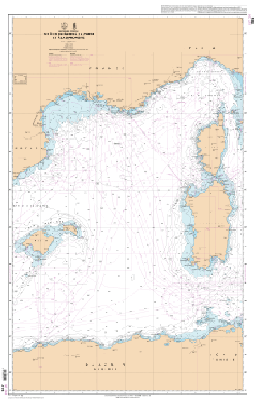
The SHOM charts East Spain - Balearic Islands - Algeria cover the areas from Sardinia to the Balearic Islands, East Spain and Algeria. You will find all the coasts and the classic details of a SHOM chart.
Need an advice ?
SHOM CHARTS EAST SPAIN - BALEARIC ISLANDS - ALGERIA : MARITIME CHART SPAIN ALGERIA
The SHOM charts East Spain - Balearic Islands - Algeria cover the areas from Sardinia to the Balearic Islands, East Spain and Algeria. You will find all the coasts and the classic details of a SHOM chart.
THE SHOM CHART
A SHOM chart is made of paper and latex in order to offer a very good resistance to water while keeping a good writing facility. These charts are folded and updated.
Details of areas and scales at the bottom of the page.
Read more
Technical specifications
- Dimensions:
- Folded: A4 (21 x 29.7 cm)
- Unfolded : A0 (84,1 x 118,9 cm)
- Available areas:
- 7008 L - from Cabo de San Sebastian to Fos-sur-Mer - Scale : 1 : 250000
- 7014 L - from the Balearic Islands to Corsica and Sardinia - Scale : 1 : 1000000
- 7015 L - from Gibraltar to the Balearic Islands - Scale: 1 : 1100000
- 7203 L - from the Balearic Islands (Islas Baleares) to Marseille - Scale: 1 : 500000
- 7660 L - Islas Ibiza, Formentera, Cabrera and southwest coast of Mallorca - Scale: 1 : 350000
- 7661 L - from Cabo de la Nao to Barcelona and Islas Baleares - Scale: 1 : 425000
- 7663 L - from Cabo de Barcelona to Cabo Cerbere - Scale: 1 : 175000
- 7664 L - from Cabo Tortosa to Cabo de Tossa - Scale: 1 : 175000
- 7665 L - from Cap Negre to Cap Cerbere - Scale: 1 : 50000
- 7669 L - from Cabo de la Nao to the port of Sagunto - Isla de Ibiza and Isla de Formentera Scale: 1 : 175000
- 7670 L - from Cabo de Palos to Cabo de la Nao - Scale: 1 : 175000
- 7671 L - from Cabo de Gata to Cabo de Palos - Scale: 1 : 175000
Upgrade your gear
Write Your Own Review


