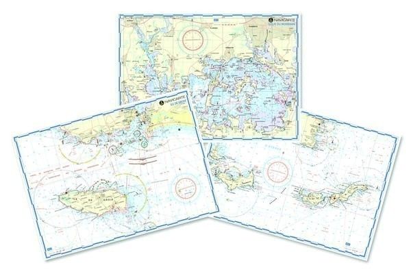
Laminated Mediterranean Sea Map
€10.00
SKU
PL-MININAV-MED-FR
Ref. : PL-MININAV-MED-FR

The Mininav Mediterranean France charts from Navicarte are ideal for light navigation along the French coast.
Need an advice ?
LAMINATED NAUTICAL CHARTS MEDITERRANEAN: MININAV NAVIGATION CHARTS
The Mininav Mediterranean France charts from Navicarte are ideal for light navigation along the French coast.
In A3 format, they are very practical for light navigation.
Read more
Technical specifications
- A3 format
- WGS 84 projection system
- GPS compatible
- Laminated maps, ideal for light navigation
Write Your Own Review


