SHOM Mediterranean charts Gulf of Genoa - Corsica - Sardinia

Shom Mediterranean charts Gulf of Genoa - Corsica - Sardinia cover the Mediterranean area between the Gulf of Genoa, Corsica and Sardinia. It includes all the coasts and the classic details of a SHOM chart.
Need an advice ?
SHOM MEDITERRANEAN MAPS GULF OF GENOA - CORSICA - SARDINIA : SHOM MEDITERRANEAN MAP
Shom Mediterranean charts Gulf of Genoa - Corsica - Sardinia cover the Mediterranean area between the Gulf of Genoa, Corsica and Sardinia. It includes all the coasts and the classic details of a SHOM chart.
THE SHOM CHART
A SHOM chart is made of paper filled with latex to give it a high resistance to water while keeping a certain ease of writing. These charts are folded and updated.
Details of areas and scales at the bottom of the page.
Find our selection of on our site.
Read more
Technical specifications
- Dimensions :
- Folded: A4 (21 x 29.7 cm)
- Unfolded : A0 (84,1 x 118,9 cm)
- Available areas:
- 6929 L : Coastline of Porto-Vecchio - From Favone cove to Lavezzi islands - Scale : 1 : 51341
- 6822 L : North side of Bastia - Scale : 1 : 50281
- 6823 L : South side of Bastia - Scale : 1 : 50625
- 6850 L : Saint-Florent,Centuri,Macinaggio - Scale : 1 : 15000
- 6851 L : Ports of Ajaccio and Propriano - Scale : 1 : 10000
- 6855 L: From Alistro lighthouse to Solenzara - Scale : 1 : 50985
- 6856 L: Approaches and port of Bastia - Scale: 1 : 14997
- 6911 L : Gulf of Porto-Vecchio - Scale : 1 : 14998
- 6929 L: Porto-Vecchio surroundings - From Favone cove to Lavezzi islands - Scale: 1 : 51341
- 6942 L: From Punta d'Orchina to Cap Muro - Ajaccio's outskirts - Scale: 1 : 51064
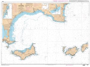
- 6951 L : From Fos-sur-Mer to Capo Mele - Scale : 1 : 249330
- 6963 L: From Gombo to Piombino channel - Elba, Capraia and Gorgona islands - Scale : 1 : 100000
- 6969 L: From Cap Corse to Punta di l'Acciolu - Gulf of Saint-Florent - Scale : 1 : 50281
- 6970 L: From Punta di l'Acciolu to Capo Cavallo - Scale: 1 : 50467
- 6980 L: Ile Rousse - Sant'Ambrogio - Calvi - Scale: 1 : 15000
- 7018 L : From Portofino to San Rossore - Scale : 1 : 100000
- 7019 L : From Imperia to Portofino - Scale : 1 : 100000
- 7024 L: Bouches de Bonifacio - Scale: 1 : 51563
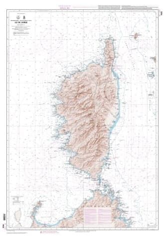
- 7025 L: Island of Corsica - Scale: 1: 253 000
- 7050 L: From Calvi to Cargèse - Scale: 1 : 50713
- 7096 L: Bay of Figari - Port of Bonifacio - Scale: 1: 10000
- 7162 L: From Cap Muro to Cap de Feno - Scale: 1 : 51355
- 7175 L: From Elba Island to Promontorio Argentario - Scale: 1 : 100000
- 7189 L: Gulfs of Olbia and Aranci - Tavolara and Molara Islands - Scale: 1: 24996
- 7190 L: Gulf of Congianus - From Capo Ferro to Capo Figari - Scale: 1: 24995
- 7191 L: Archipelago of the Maddalena - Scale: 1 : 25000
- 7229 L: From Nice to Piombino - Scale: 1 : 250000
- 7280 L: Gulf of Ajaccio - Scale: 1 : 25000
- 7292 L: From Corsica to Sicily (Sicilia) and Cape Bon (Ras at Tib) - Scale: 1 : 1000000
- 7316 L: Gulf of Sagone - Scale: 1 : 25000
- 7436 L: Approaches and port of Bastia - Ajaccio and Propriano - Cartouche A: Port of Ajaccio - 1 : 7 500 - Cartouche B: Port of Propriano - 1 : 10 500 - Cartouche C: Approaches and port of Bastia - 1 : 15 000
- 7442 L : From Villefranche-sur-Mer to Menton - Scale : 1 : 20000
- 7443 L : From Cap Ferrat to Capo San Lorenzo - Scale : 1 : 49600
- 7508 L : From Capo Caccia to Capo Sant'Elia - Scale : 1 : 250 000
- 7509 L : From Capo Sant'Elia to Capo Bellavista - Scale : 1 : 250 000


